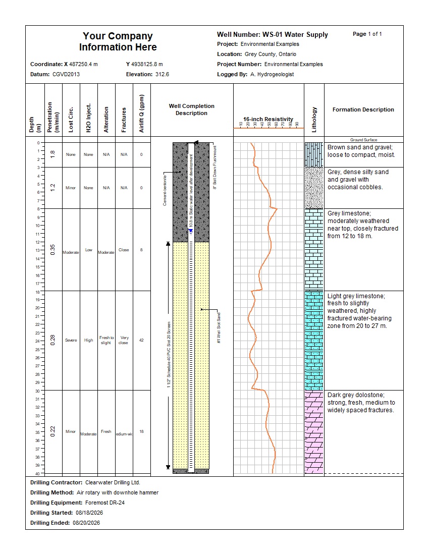

This example shows how WinLoG documents a municipal or private water-supply well from drilling through completion. WS-01 Water Supply combines drilling observations, well construction, lithology, formation descriptions, and a 16-inch resistivity profile on one coordinated depth scale.
The 40 m well penetrates sand and gravel, silty sand and gravel, limestone, and dolostone. It records penetration rate, lost circulation, alteration, fractures, airlift discharge, casing, grout, screen, filter pack, and formation resistivity. Automated validation reports Passed, 100% completeness, 85% confidence, and no warnings or errors.
This record demonstrates how formation descriptions and drilling observations can be shown beside a detailed completion diagram and a continuous geophysical curve. The shared depth scale makes it easy to relate water-bearing fractures and airlift yield to lithology, resistivity, casing, grout, screen, and filter-pack placement.
The supplied validation report records Passed status, 100% completeness, Good quality, an 85% confidence score, zero warnings, and zero errors.
Download the example files individually. The XML template and log can be imported into WinLoG Version 6 and customized for water-supply and groundwater workflows.
Demonstrates a practical workflow for documenting aquifers, water-bearing fractures, yield observations, and final well construction.
Shows how penetration, lost circulation, lithology, casing, screen, grout, filter pack, and airlift yield share a common depth scale.
Provides an integrated record for reviewing formation data, construction depths, geophysical response, completeness, and consistency.
WinLoG templates can be customized to match company standards, project requirements, and agency formats. Construction components, drilling observations, lithology, yield data, geophysical curves, and validation rules can be tailored to project requirements.
Contact GAEA Technologies
GAEA Technologies develops and distributes geoscience and engineering solutions worldwide. Our solutions have been used for over 30 years by companies and organizations around the world.
© 2026 - All Rights Reserved/span>