Seismic Section Digitization Solution

Digitize Your Seismic Data Efficiently

Are you ready to transform extensive seismic data into valuable insights?



svg icon 


Overwhelmed by vast geophysical data.

svg icon 


Frustrated with slow digitization processes.

svg icon 


Struggling to meet critical project deadlines.

svg icon 


Unable to access organized data when needed.

svg icon 


Experiencing delays in analysis and reporting.

svg icon 


Missing opportunities due to inefficiency.

image
choose images
svg icon 


Transform your seismic data swiftly and affordably.

svg icon 


Gain organized access to critical geophysical insights.

svg icon


Cost-effective solutions that fit your budget.

svg icon


Save time and resources while meeting deadlines.

We Understand Your Challenges

With 3,000+ clients worldwide, we have the solution you need.

svg icon

3,000+ Companies Trust Us

Join thousands who rely on our software for their projects.


svg icon

120+ Countries Use Our Solutions

Working globally to simplify geotechnical and geoscientific data handling.


svg icon

Created by Professionals Like You

Engineered and designed for performance—trusted by professionals like you.

Fast, Affordable Digitization for Geophysicists

Unlock the full potential of your seismic data with our fast, low-cost digitization solution. Seamlessly interpret seismic sections within your preferred software workstation and effortlessly navigate vast datasets. Say goodbye to inefficient processes—it's just plain wrong to struggle with outdated methods. Take the first step and get a quote now!

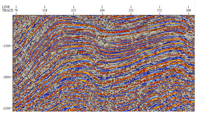
We can digitize your old 2D (18 to 24 trace recording) seismic sections into SEG-Y format for use in seismic interpretation software. The input to the vectorization process are scanned images of seismic sections in TIFF, GIF, JPEG, or PNG formats. Most colour seismic sections can be accurately digitized in to SEG-Y, such as, grey scale, black to red, and red to blue.

Navigation information can be added to the SEG-Y file for easier loading. The navigation data can be supplied as X and Y values or can be digitized from seismic line maps. The cost can be as low as $0.50 per trace depending on the amount of data to be digitized.

 

3 Simple Steps to Effortlessly Digitize Your Seismic Data

Transform your seismic data into valuable insights with our easy and efficient process.

svg icon

Request a Quote

Contact us for a tailored quote for your needs.


svg icon

Send Us Your Data

Upload your seismic sections for digitization.


svg icon

Receive Your Digitized Data

Get your organized data delivered promptly and efficiently.


Struggling to digitize vast seismic data efficiently? We can help.

As a geophysicist, you're faced with vast amounts of geophysical data, and you know that inefficient digitization processes can lead to frustration and delays. We understand your struggles, and we're here to help. Our fast and affordable digitization solution, crafted by experts, enables you to transform cumbersome data into organized, accessible formats. By choosing our service, you’ll not only save time and resources but also streamline your workflows, allowing you to focus on what truly matters—delivering critical insights on time.


Thank you for your interest in our data solutions, we appreciate your time. Please use the link below to download our free LAS (Log Ascii Standard) utilities app, that can be used to view, compare, and summarize LAS files.